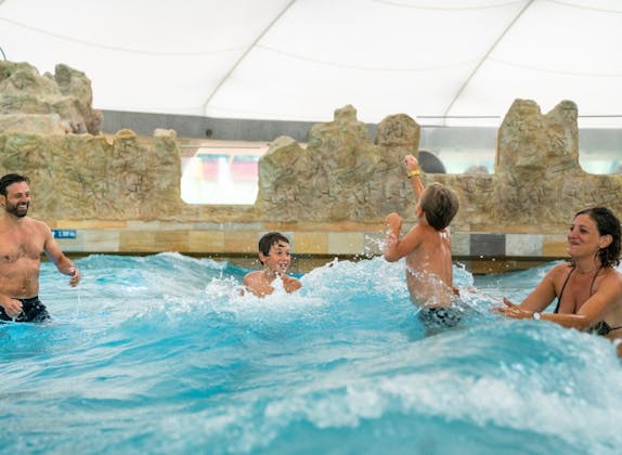
Pool and slides ticket to Splash and Spa
Validity: All day

8 Activities

Validity: All day
Validity: All day
Why book with Swiss Activities?
Duration: 30 minutes

Validity: All day
Duration: 8 hours

Validity: All day
Validity: All day

Validity: All day

Ticket
booked 41 times
Ticket
booked 18 times
Why book with Swiss Activities?

Adventure
Duration: 30 minutes

Ticket
booked 11 times

Tour
Duration: 8 hours

Rent

Games
booked 6 times

Games
You can find more information about Ticino in our article Hiking in Ticino with 30 mountain railroads.
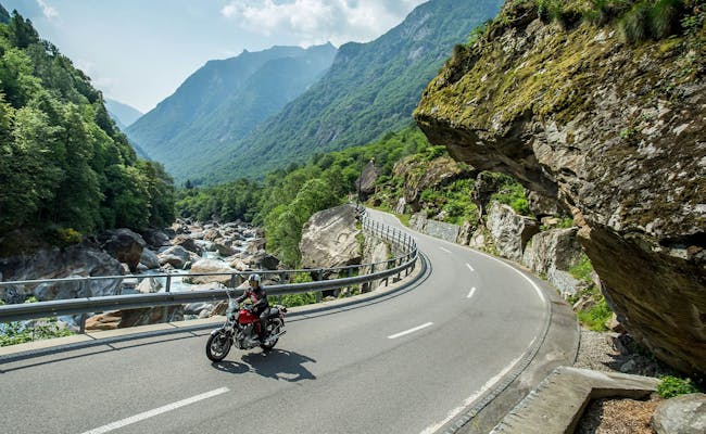 Autobahn (Foto: Tessiner Tourismusagentur ATT SA)
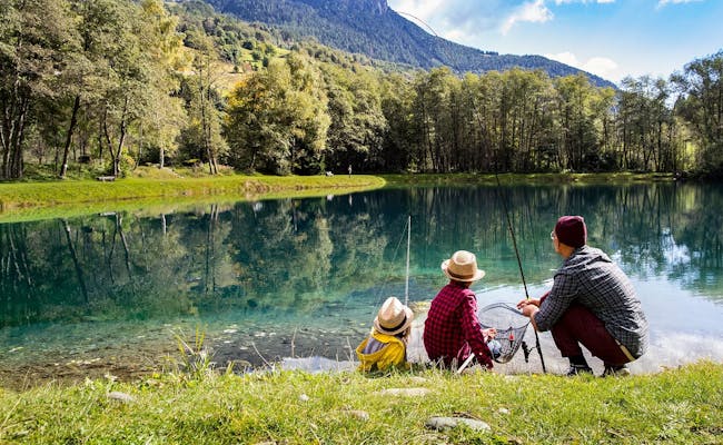 Bergsee (Foto: Tessiner Tourismusagentur ATT SA)
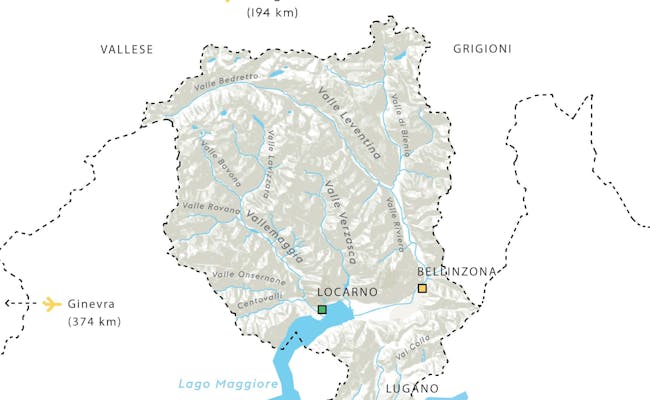 Tessinkarte (Tessiner Tourismusagentur ATT SA)
The regions of Ticino combine a unique diversity of nature, culture and tradition.
Northern Ticino, with the main valleys of Leventina, Blenio and Riviera, is alpine. The Swiss Alps characterize the region, which in winter offers beautiful ski resorts with corresponding lift facilities. In summer there is hiking or mountain biking. The chairlifts are also in operation on summer weekends.
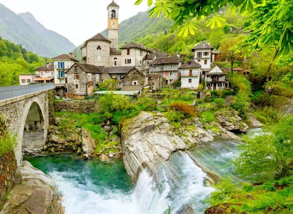
Located in the northwest of Ticino, the region borders Lake Maggiore to the south. It is characterized by the Maggia Valley (Vallemaggia) and the wild Verzasca Valley. In the Verzasca Valley, the Roman bridge of Lavertezzo is a well-known postcard motif. The Vallemaggia is the largest valley in Ticino and stands for a lot of untouched nature and greenery between the mountains
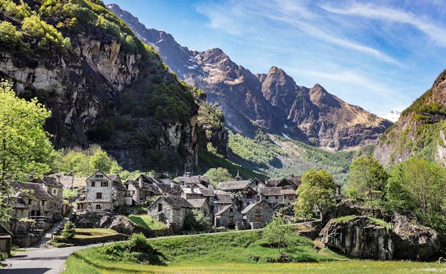 Maggiatal (Foto: Tessiner Tourismusagentur ATT SA)
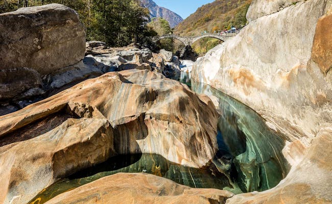 Verzascatal (Foto: Tessiner Tourismusagentur ATT SA)
The central western part of Ticino belongs to the Lago Maggiore region. Some famous towns around the lake are Locarno, Ascona and Brissago. This is where the Mediterranean flair of Ticino begins. Hot summers and mild winters ensure that even here palm trees and jacaranda trees make the hearts of vacationers beat faster. In the north, the Centovalli with its many side valleys and the Onsernone Valley follow.
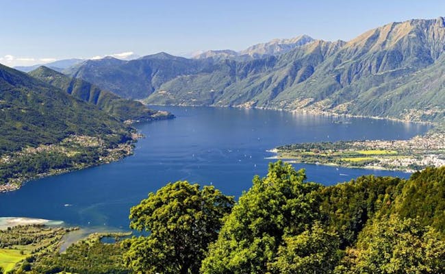 Lago Maggiore (Foto: Tessiner Tourismusagentur ATT SA)
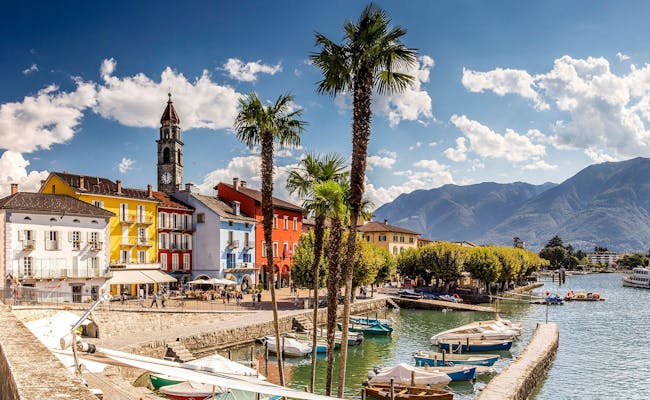 Lago Maggiore (Foto: Tessiner Tourismusagentur ATT SA)
The Bellinzona region is located in the eastern part of Ticino. Here is the main traffic axis of Ticino, as the routes of the Gotthard Pass and the San Bernardino Pass join. Through the Magadino plain flows the river Ticino (Ticino) to Lake Maggiore to flow into it. Bellinzona as the cantonal capital of Ticino, however, also combines the Middle Ages and modernity excellently.
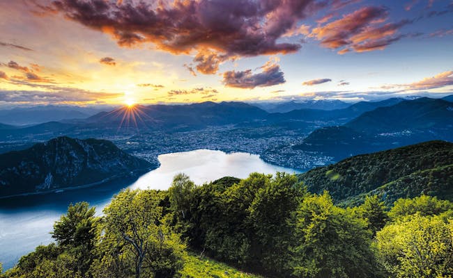
In southern Ticino and below the regions of Lake Maggiore and Bellinzona is the Lake Lugano region. The city of culture Lugano is the most important city. This region is also called "Sottoceneri", that is, the region below the Monteceneri. The Monteceneri is a pass at 554 meters above sea level that separates the Magadino plain from the Vedeggio valley. Since 2020, the Ceneri base tunnel has ensured that trains can reach the south even faster or vice versa.
This small region forms the southernmost tip of Ticino and is enclosed on three sides by Italy. The towns of Breggia, Chiasso and Mendrisio characterize the region. The municipality of Balerna is divided by the A2 highway, which continues into Italy. Breggia and San Pietro are surrounded by beautiful and hilly nature, most of which is now protected. Chiasso is the southernmost town in the whole of Switzerland.
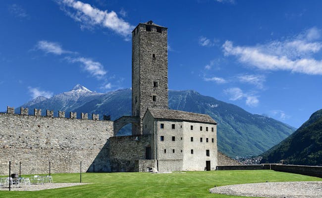 Bellinzona (Foto: Tessiner Tourismusagentur ATT SA)
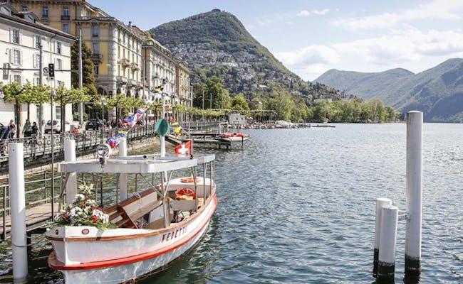 Luganersee (Foto: Tessiner Tourismusagentur ATT SA)
Ticino has, in addition to a wonderful nature, some beautiful old towns with Italian-influenced architecture. They have very special buildings that want to be admired. In Lugano it is mainly the churches and at their top the Cathedral of San Lorenzo.
In addition, there are four UNESCO World Heritage Sites in Ticino.
The three UNESCO World Heritage Sites in Ticino are very different and refer to the Cultural Heritage, the Natural Heritage and the Intangible World Heritage.
The three medieval castles of Bellinzona have been part of the UNESCO World Heritage since 2000: Castelgrande, Montebello and Sasso Corbaro.
"The fortresses of Bellinzona are an outstanding example of a late medieval defensive structure in a strategic position for the crossing of the Alps. The castles of Bellinzona are among the most important testimonies of medieval fortified architecture in the Alpine region."
They were built around the 15th century by the Dukes of Milan on the north-south axis of the Alpine roads as a bulwark to block the passage.
From the old town of Bellinzona, the three castles can be visited with the Artù tourist tram. in addition, there is an explanatory museum in each case. On June 10, World Heritage Day, there will be additional activities for children and families.
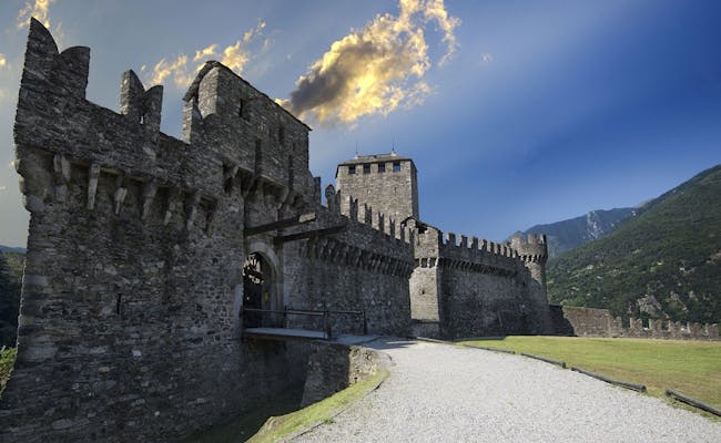 Castelo Montebello (Foto: Tessiner Tourismusagentur ATT SA)
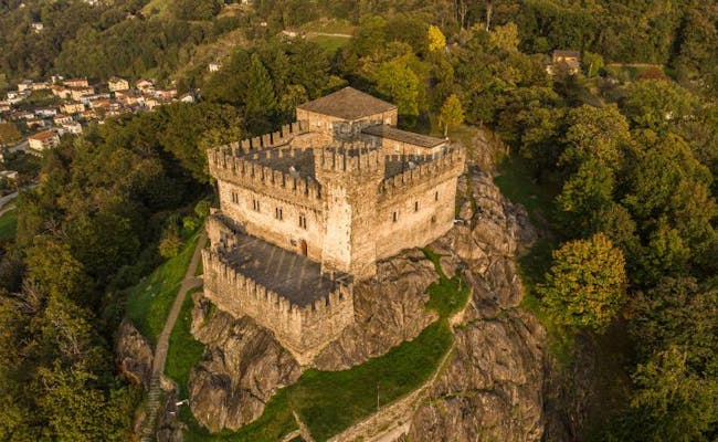 Sasso Corbaro (Foto: Tessiner Tourismusagentur ATT SA)
UNESCO World Natural Heritage can be found at Monte San Giorgio. The fossils from the Middle Triassic have been part of it since 2003. They date back to 250 million years ago. in 2010, the Italian side of Monte San Giorgio was also added to the UNESCO list.
At that time, what is now Ticino was still largely seabed. In the Fossil Museum of Meride on Monte San Giorgio, visitors can see this ancient world with their own eyes in a replica. The fossils show in a rare sharpness the remains of dinosaurs, but also of fish, reptiles and plants. The entire mountain is a treasure trove of fossils of the very highest quality. To date, about 20,000 fossils have been recovered. June 10 is World Heritage Day, and in addition to free tours, the museum will offer workshops for children that day. A novelty is the Triassic Park and the Trias Aquarium, which are offered in augmented reality (AR) and virtual reality (VR).
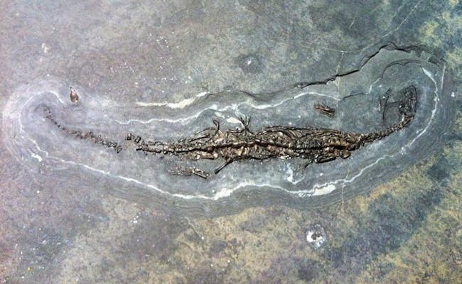 Saurierfossil (Foto: Tessiner Tourismusagentur ATT SA)
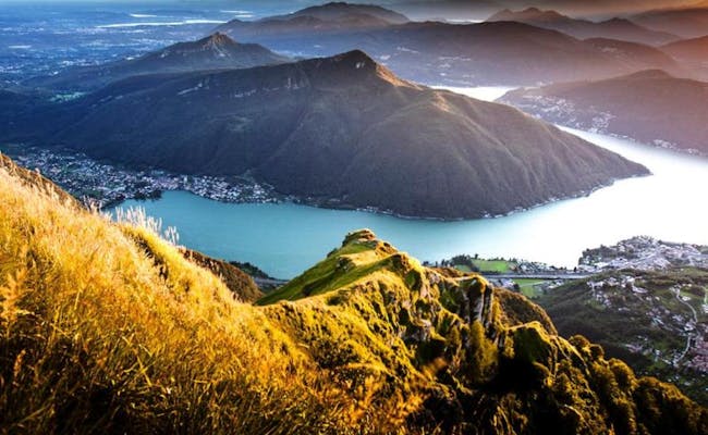 Monte San Giorgio (Foto: Tessiner Tourismusagentur ATT SA)
The Holy Week processions in Mendrisio became UNESCO Intangible World Heritage in 2019. They are already documented since the second half of the 17th century. Always on the evenings of Holy Thursday and Good Friday, the processions pass through the old town of Mendrisio. To enhance the effect, the street lighting is then switched off
The lights of the "Trasparenti" give light. These large illuminated pictures are painted on translucent canvases and are stretched along the route over the alleys. They depict scenes from the Old Testament and from the Gospel. On Maundy Thursday, 270 amateur actors (without dialogue) perform a series of scenes from the Gospel. Sumptuous costumes depict biblical characters, horsemen and Roman soldiers. On Good Friday, the procession is more simple and solemn. More than 600 members of church associations and various brotherhoods parade through the city with statues. Funeral music accompanies the procession. Riding tambourines form the beginning and the end of the procession
Since July 2021, the ancient beech forests of the Valli di Lodano, Busai and Soladino in side arms of the Maggia Valley in Ticino have also been included in the UNESCO World Heritage List. Together with the beech forests on the Bettlachstock in the Jura Mountains of Solothurn, they have been honored with this designation. In total, UNESCO has now added eleven new forests in Europe to the list of important ancient beech forests in Europe.
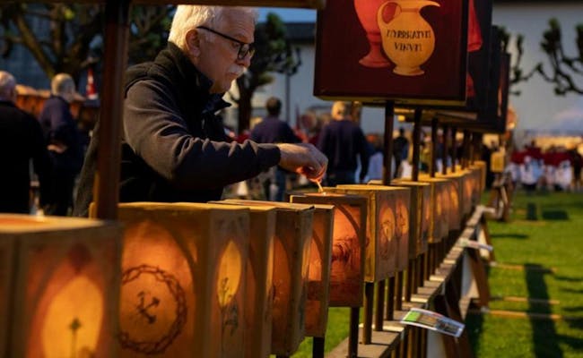 Prozessionen Mendrisio (Foto: Tessiner Tourismusagentur ATT SA)
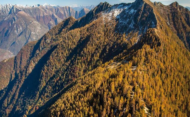 Buchen im Valle di Lodano (Foto: Tessiner Tourismusagentur ATT SA)
The old towns of Lugano and Bellinzona are particularly worth seeing. The old towns of Locarno and Ascona are also beautiful. Guided city tours are offered everywhere, giving visitors a good overview within a short time. From the old town in Bellinzona, you can quickly reach the three castles, which are UNESCO World Heritage Sites, by tourist train.
The Cathedral of San Lorenzo, six churches and two Capuchin monasteries in the old town of Lugano are particularly pretty to look at. Built at the beginning of the ninth century, the cathedral was recently restored and now shines in new (old) splendor. The portal was redesigned in the Renaissance period. Inside the cathedral you can admire valuable frescoes and ornate Baroque parts
The church of Santa Maria degli Angioli used to be part of a Franciscan monastery. In it you can admire beautiful frescoes from the middle of the 16th century, which occupy entire walls.
At least six sumptuous palazzi were built between the fifteenth and nineteenth centuries. Several piazzas with restaurants and day bars make the Italian feeling perfect
In particular, the Piazza della Riforma is known for its buildings from the classicist period. Many restaurants and bistros ensure that this square is very frequented by visitors. Throughout the year, large events are always held here. The waterfront promenade is also very popular. Palm trees grow here and cozy benches, small cafes and gelaterias invite you to linger.
For visitors who are visiting Lugano for the first time or simply want to get to know it better, it is worth taking part in one of the free guided tours of the city.
Every Saturday a guided city walk is offered starting at the tourist information office at the SBB train station. It shows historical alleys, piazzas and palazzi. In addition to the magnificent cathedral, you will see a magnificent park and, to top it off, experience an overview of the entire city of Lugano from above.
On Mondays, a guided tour of the city starts at the Lugano Region Tourist Office in Piazza Riforma and is led by actors from the city. They wear costumes and in their entertaining tour they put special emphasis on the many facets of the city, its important personalities and special places.
The Lugano Region Tourist Board (Ente Turistico del Luganese) organizes other city tours, for example Lugano, past and present.
The newly built Art and Cultural Center of the City of Lugano contains a museum and a concert and theater hall. The massive building stands at Piazza Bernardino Luini 6 and offers changing programs and exhibitions
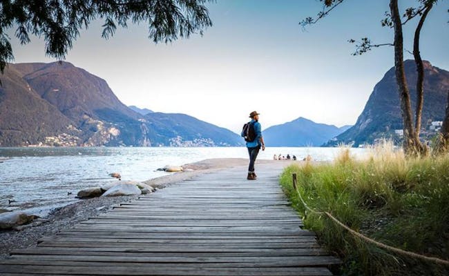 Lugano (Foto: Tessiner Tourismusagentur ATT SA)
 Unexpected Classic Tour (Foto: Tessiner Tourismusagentur ATT SA)
Bellinzona is the capital of Ticino and is situated at 238 meters above sea level on the Ticino River, not far from where it flows into Lake Maggiore. The town is primarily known for the three castles above the old town, which are part of the UNESCO World Heritage. However, the old town also has interesting and inviting squares. For lunch, for example, you are sure to find a nice spot in the beautiful Piazza Collegiata
The narrow streets look especially romantic every Saturday morning. Then the weekly market is held here. Visitors should not miss this experience. Artisans sometimes produce their goods right in front of the customers. In spring and autumn the market is also held on Wednesdays
In February, the city becomes a boisterous celebration site during the carnival season. More than 150,000 guests come to Bellinzona during Carnival week to celebrate In the Realm of King Rabadan Carnival exuberantly for five days. In Bellinzona it is also worth visiting the art museum or booking a guided excursion. A guided tour of the city, including a visit to the castle, takes place every Saturday morning from 11:00 a.m. from the beginning of March to mid-December. The meeting point is the tourist office in Piazza Collegiata. The tour is not free of charge, but takes place already from 1 person.
Locarno is located on the northern shore of Lake Maggiore and, together with Lugano and Grono, is one of the warmest places in Switzerland. The Mediterranean climate and the location directly on the lake attract many tourists. Lemon trees and palm trees grow here. The townscape of Locarno is one of Switzerland's sites worthy of protection.
The center of the city is the Piazza Grande. It was built around the eighth century. Here the Lombard arcades stretch along the houses for over 700 meters. Among them are restaurants and numerous stores. Magnificent town houses line the square. Their columns, loggias and arcades (portici) are still in their old splendor and their courtyards, arcades and terraces show the special charm of the old town. The medieval city tower is visible from the piazza
From here, steep alleys lead up to the old town proper. These alleys are the oldest parts of Locarno and are largely car-free. Some houses are still adorned with old family coats of arms, frescoes or decorated window sills.
Ascona is located on the northern shore of Lake Maggiore not far from the town of Locarno. Both towns are separated by the river Maggia. The town is known for its Mediterranean architecture and the lakefront promenade, which is well stocked with cafes. The lake promenade was built as early as the 13th century
The old town of Borgo features a 16th century church dedicated to Saints Peter and Paul. The high bell tower of the columned basilica became the town's landmark. Ascona has long been a city for artists and intellectuals. In their honor, a museum was equipped on the hill Monte Verità in a historic park
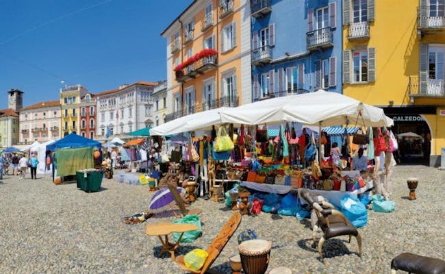 Piazza Grande (Foto: Tessiner Tourismusagentur ATT SA)
 Locarno Altstadt (Foto: Tessiner Tourismusagentur ATT SA)
Ticino has 72 mountain peaks to offer, almost without exception, a wonderful view of the lake and valley landscape. In the background, the snow-covered Alps form a beautiful contrast. The lowest peak in Ticino is that of Monte San Salvatore at 912 m a.s.l. The highest peak is that of the Rheinwaldhorn at 3,402 m a.s.l. 135 valleys and 148 lakes also make the choice not easy.
Below are some of the most popular mountains, lakes and valleys of Ticino, as well as particularly interesting places for excursions explained in a little more detail.
We have compiled only a small selection of very many interesting excursion locations here. They are particularly popular or unusually interesting.
The village of Gandria has now been incorporated into Lugano. It is located on the northern shore of Lake Lugano at 295 meters above sea level on a steep slope of Monte Brè. From the Lugano train station it is five kilometers away in an easterly direction. The fascination that still today emanates from this small town is related to the fact that here you can dive into the past. The small alleys by the lake perfectly reflect the former life. Nothing has changed here for more than a hundred years. You can get to the village either by boat or along the olive tree path, a picturesque nature trail. The Lugano Tourist Office offers a free guided tour every Friday afternoon during the summer, following the boat trip. Prior booking is required.
Above Locarno, in Orselina, there is a pilgrimage church dedicated to the Madonna del Sasso. According to tradition, the Virgin Mary appeared on this elevation in 1480. Since then, believers have been making pilgrimages here in large numbers. There is even a funicular going up from Locarno. Those who go on foot either take the steep Way of the Cross or a path through the wild valley. There are several chapels along the way.
The pilgrimage church is full of works of art, magnificent frescoes and stucco work. A former monastery next to the church now houses a museum.
The Tibetan Bridge "Carasc" connects the municipalities of Sementina and Monte Carasso. In this way, the otherwise impassable valley can be crossed comfortably. The bridge was built by the Curzùtt-S. Barnàrd Foundation and is subject to considerable safety measures. Crossing the bridge is an experience for young and old.
Facts:
The best way to reach the bridge is by cable car from Monte Carasso to Curzùtt. It is advisable to purchase the cable car tickets in advance, as this is a very popular destination. Curzùtt is a pretty traditional and historically preserved village center.
Monte Carasso is a district of Bellinzona. It is best to park the car in the public parking lot in Via Tatti. Afterwards you can take the post bus line 2 from Bellinzona or walk (about 15 minutes). Also arriving by train, the bus of line 2 can be used. There is also a shuttle bus between the train station and the valley station.
The Brissago Islands are two islands in the Swiss part of Lake Maggiore. Because of the subtropical climate prevailing there, plants grow here that do not otherwise occur in these latitudes. Palm trees also thrive magnificently. Therefore, a botanical garden was established on the larger of the two islands as early as the end of the 19th century. In the 20th century, a villa with an orangery and Roman baths was also built here. Since 1949 the islands have been owned by the Canton of Ticino and several municipalities. They have been open to the public since then. The islands are located near Brissago and Ascona.
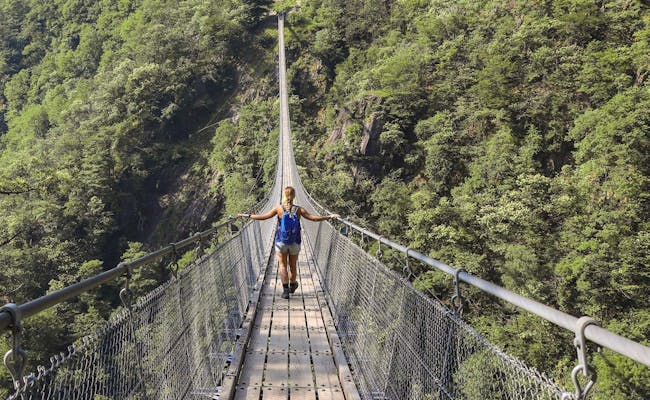 Tibetische Brücke (Foto: Tessiner Tourismusagentur ATT SA)
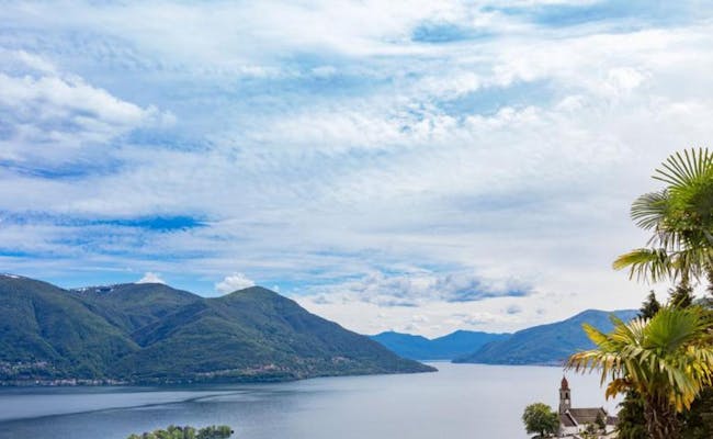 Brissago Inseln (Foto: Tessiner Tourismusagentur ATT SA)
Although Ticino has a Mediterranean flair in large parts, there are also several beautiful mountain peaks here
The Lukmanier Pass in the north, at 1916 m above sea level, is a Swiss Alpine pass and also forms the border with Graubünden. The hiking mountain Matro (2172 m above sea level) is one of the few mountains whose summits offer a panoramic view. From Bellinzona, mountain enthusiasts can quickly reach the peaks of Gaggio and Molinera, and no less than three mountain peaks can be reached in a short time by mountain railroad from Lugano in the south of Ticino.
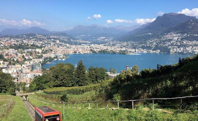
Monte Brè is the local mountain of Lugano. It is also called the sunniest mountain in Switzerland and is 933 m above sea level. The view goes to Lake Lugano, Monte Rosa and the Bernese and Valais Alps. The mountain is reached from Lugano by boat from the Debarcadero boat landing point in the direction of Cassarate. A cable car leads to the top of the mountain and the village of Brè can be reached on foot after a walk. The old stone houses, the church and the cemetery are worth seeing. The museum Wilhelm Schmid shows his works as a painter in the house where he was born. Every Friday morning from May to October the tourist office offers a guided tour. The guided tour itself is free of charge. Prior registration is absolutely necessary.
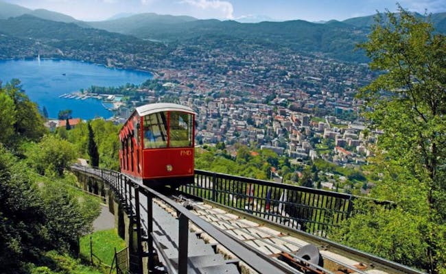 Monte Brè (Foto: Tessiner Tourismusagentur ATT SA)
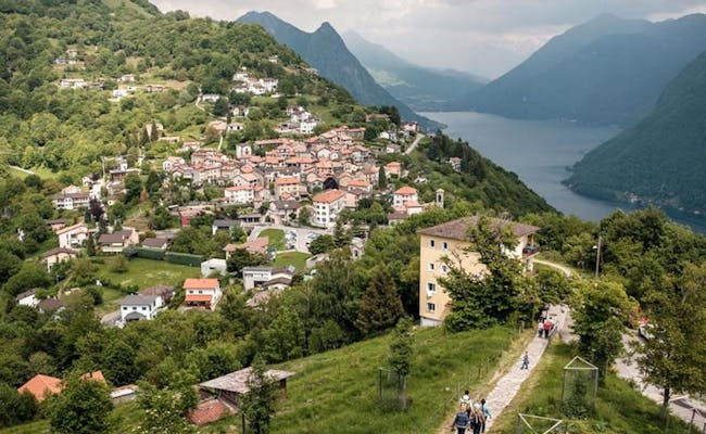 Monte Brè (Foto: Tessiner Tourismusagentur ATT SA)
Monte San Salvatore reaches 912 meters above sea level at the summit. The mountain is located directly on Lake Lugano and is the second local mountain of Lugano. The panorama extends at the summit from the small lookout tower (12.5 meters high) from left to right over Lugano, Campione d'Italia to Melide. The incomparably beautiful panorama alone leads many visitors to the top. The funicular, which takes 12 minutes to reach the summit, makes the decision easier
In addition to a chapel, you can also visit a museum at the summit with ecclesiastical and geological exhibits and information (open Wednesdays to Sundays). The building in which the museum is located is already interesting. It was built towards the end of the 17th century for the poor and wanderers who were on pilgrimage to the Church of the Redeemer. Later it was used as a hospice. Pilgrims are said to have climbed the mountain as early as 1200 to honor the Son of God. There is a legend that Jesus stopped here for a short rest on his ascent to heaven
However, the mountain primarily offers plenty of space for physical activities. In addition to beautiful hiking trails and nature trails, there is also a popular via ferrata here. The museum in San Salvatore displays rocks and fossils from the mountain and provides information about local speleology. There is also a children's playground and for families or school groups, the treasure hunt along the nature trail is suitable. It is easy to walk and offers only a few meters of difference in altitude.
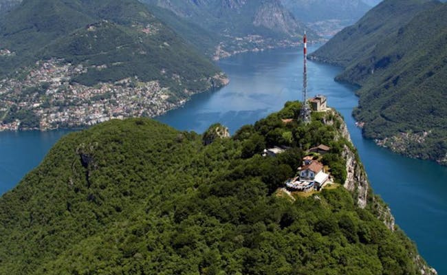 San Salvatore (Foto: Tessiner Tourismusagentur ATT SA)
 San Salvatore (Foto: Tessiner Tourismusagentur ATT SA)
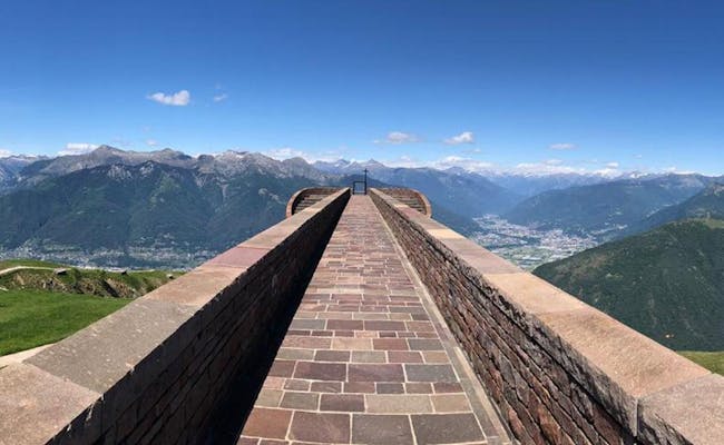
Monte Tamaro is located at 1961 meters above sea level near the northern part of Lake Maggiore. From the summit, Alpe Foppa at the top station of the aerial tramway is still a one and a half hour hike away.
At Alpe Foppa there is a mountain lake that can be circumnavigated. As for activities, the mountain offers a summer toboggan run, tyrolienne, children's playground and several hiking and biking trails. At the middle station Piano di Mora a rope park provides fun and thrills. The Tamaro Jumping is part of the rope park.
From Lugano, the valley station of the gondola lift to Monte Tamaro is reached in just under half an hour; from Locarno, it also takes half an hour.
 Monte Tamaro Kirche (Foto: Tessiner Tourismusagentur ATT SA)
 Monte Tamaro Rodelbahn (Foto: Tessiner Tourismusagentur ATT SA)
Monte San Giorgio reaches 1097 m on the Swiss side and is located at the foot of the Southern Alps on the border with Italy. The mountain is surrounded by the two southern arms of Lake Lugano. Monte San Giorgio is an important site for marine fossils from the Middle Triassic (247-237 million years ago). Because of the abundance and detail of the fossils, they have been declared a UNESCO World Heritage Site. Therefore, the mountain is also called "Saurian Mountain".
Monte San Giogio is reached by train via the Mendrisio stop. The bus line 524 goes from Mendrisio Stazione about 20 minutes to Meride Paese. By car it takes from:
There are limited parking spaces available (40 free and 25 paid parking spaces, plus a disabled parking space not far from the Fossil Museum). A boat trip can be planned in summer to Brusino Arsizio. From there, take the cable car up to Serpiano and Meride is about an hour's walk along a pleasant path.
The mountain is perfect for walking through the vineyards. A hike to the village of Riva San Vitale at the southern end of Lake Lugano is also worthwhile because of the baptistery located there. It is considered the oldest Christian building in Switzerland and dates back to the 5th century.
Located 1704 m above sea level, Monte Generoso has an extensive view of the Gran Paradiso Alpine range. The arc continues from the Matterhorn (Cervino) to the Monte Rosa massif and from the Jungfrau to the Gotthard massif and Piz Bernina in the east. The lake landscape of the northern Italian lakes forms a pleasant contrast.
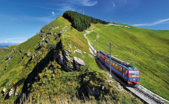
Often, on a clear day, even the Alpine chain of the Italian Maritime Alps can be seen in the southwest. Monte Generoso is also called Calvagione. It is reached from April to October by a nine-kilometer-long rack railroad from Capolago on Lake Lugano. The border with Italy runs across the mountain.
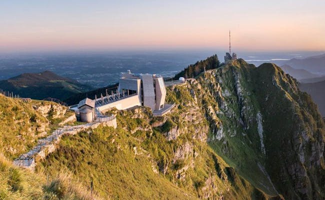
A work by architect Mario Botta catches the eye. On the rocky plateau of Monte Generoso, he built the "Fiore di pietra" (Stone Flower) as a restaurant. The mountain panorama is reflected in the windows in a sophisticated way.
In July 2021, the first "Swing the World" swing in the Mendrisiotto was installed on Monte Generoso. The giant panoramic swing offers a 360-degree view of Lake Lugano and Lake Maggiore, the Alpine chain, the Muggio Valley and the Po Valley.
 Monte Generoso (Foto: Tessiner Tourismusagentur ATT SA)
 Monte Generoso (Foto: Tessiner Tourismusagentur ATT SA)
Monte Lema is a mountain located at 1,619 meters above sea level and offers a special view of Lake Lugano, Lake Maggiore and the valleys around Luino. In 10 minutes you can reach the mountain from Miglieglia in Alto Malcatone by cable car. The cable car climbs 849 meters in altitude.
Monte Lema is a hiking mountain that also offers beautiful mountain bike trails. Paragliders also get their money's worth here. At the top station of the cable car there is an astronomical observatory and a restaurant with a hotel. Next to it there is a children's playground. Model pilots like to let their models fly here.
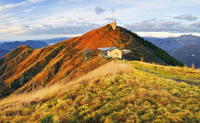 Monte Lema Trail (Foto: Tessiner Tourismusagentur ATT SA)
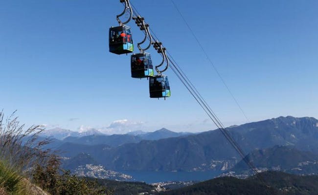 Monte Lema Bahn (Foto: Tessiner Tourismusagentur ATT SA)
Cardada Cimetta is a viewpoint above Locarno that can be quickly reached by mountain railroad and chairlift. From here you can see both the lowest point of Switzerland (Lao Maggiore) and the highest (Dufourspitze. In Cardada there is a viewing jetty and in Cirnetta you have the view from the geological observation station
The popular hiking area offers alone three Helsana Nordic Walking trails, a trail for mountain bikers and a jumping-off point for paragliders. Cardada Cimetta is located between the Maggia and Verzasca valleys and is therefore also a good starting point for excursions into these valleys
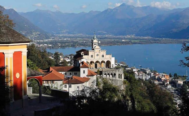 Cardada Cimetta (Foto: Tessiner Tourismusagentur ATT SA)
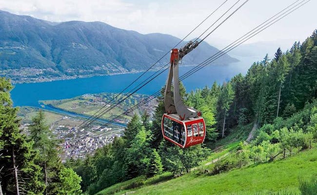 Cardada Cimetta (Foto: Tessiner Tourismusagentur ATT SA)
Ticino has a total of 148 lakes. Most of them are clear mountain lakes found in the mountains and valleys of the region. Two of the Upper Italian lakes are partly located on the Ticino territory and are also a particular tourist magnet because of the mild climate.
Ceresio is the Italian name of Lake Lugano. The glacial lake, which was formed 10,000 years ago during the Ice Age, is about 48.7 square kilometers in size with all its branches. About one third of it lies on Italian territory. Its deepest point is near Gandria and measures 288 meters. To the west of the lake, the Tresa River branches off and connects Lake Lugano with Lake Maggiore.
Lake Lugano offers a variety of active and passive activities. Fishing, for example, is very popular, as Lake Lugano is particularly rich in fish. The wide beaches and bathing establishments on the shores of the lake are very popular. Swimming in the lake is possible from May to September and for cooler weather there is, for example, the California Acquapark south of Lugano. Kayaks and canoes then populate the lake and for the particularly sporty, diving, sailing, windsurfing and water skiing are the most popular activities. Sailing and diving clubs can be found all around the Ceresio
The Brissago Islands are located on the Swiss side of Lake Maggiore and are also known as the Maldives of Switzerland. Located between Brissago and Ascona, the fastest way to reach the islands is by shuttle boat from Porto Ronco
Due to a very warm climate and the lack of ice days, many species of plants and palms grow here that are more common in more southern latitudes. The botanical gardens with subtropical plants were established already in 1885 and are very worth seeing. A total of about 1,700 plant species from all five continents grow here. The botanical garden is so unique that it is counted among the "Gardens of Switzerland". Excursion boats dock here and wedding ceremonies are very often organized on these islands.
Boat trips are popular on Lake Maggiore. A sailing trip across the lake is especially popular. Around the lake people go hiking, cycling or play tennis. All around there are even hotels specialized in certain sports
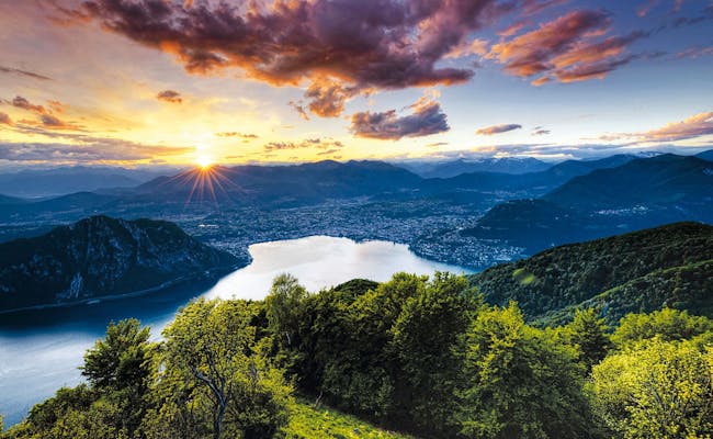 Luganersee (Foto: Tessiner Tourismusagentur ATT SA)
 Brissagoinseln (Foto: Tessiner Tourismusagentur ATT SA)
Most mountain lakes were formed after the retreat of glaciers. They are usually really clear and healthy. They are very popular as destinations for hiking tours or mountain bike rides. However, there are also many mountain lakes that can be reached by cable car without much effort.
The lake Robiei can be easily reached with the cableway San Carlo - Robiei. Here you can meet the Basodino glacier, which lies at an altitude between 2500 and 3120 meters above sea level and covers an area of two square kilometers. The lakes around Robiei were formed from melted glacier water. These lakes can be visited in hikes:
July and August are the best months for circular walks around the lakes. Glacier hikes under expert guidance are also possible. Below the Basodino glacier lies the Bavona Valley. The Caneggia waterfall can best be admired from here.
In the Maggia valley lie the mountain lakes of Sfille. They are reached in a hike starting from Cimalmotto, which is the furthest village in Val di Campo. Here, at 1,400 meters above sea level, the ascent begins. Laghetto di Sfille is at 1,900 m.a.s.l. From Cimalmotto it is also possible to reach other mountain lakes. They are rather small:
In the Onsernone Valley a cableway goes from Vergeletto-Zott to Salei. Now you take a comfortable hiking trail (about 40 minutes) to the small mountain lake. From here you have a wonderful view over the Locarnese to the Lago Maggiore.
The Chièra mountain lakes are located 2,344 m above sea level and 2,361 m above sea level. They can only be reached on foot from Sompréi (1,850 m above sea level). Cars can drive directly to Sompréi by road
Lago Retico is situated at 2,372 m above sea level. Alpe Predasca (1,738 m above sea level) is reached by car west of Campo Blenio. A three-hour hike leads to Lago Retico via Capanna Bovarina (1,870 m a.s.l. and Redich (1,993 m a.s.l.).
Frasco (885 m a.s.l. ) in the Verzasca Valley can be reached by car and by post bus. Here begins a three-hour hike above the Hotel Efra that leads to the Efra Valley. After Alpe Efra (1,686 m a.s.l.) the mountain lake at 1,836 m a.s.l. is reached.
Lake Tremorgio is considered a jewel among the mountain lakes. It is located at 1,820 m above sea level in a mountain valley basin above Rodi-Fiesso in the municipality of Prato Leventina. It is reached by cable car from Rodi.
Lago Ritóm is situated at 1,850 meters above sea level in the Piora Valley, a side valley of the Leventina. It can be reached by the funicular railroad Ritombahn from Piotta. It used to be a natural lake with the rare phenomenon of superimposed water layers that do not mix (meromixis)
Further north, at 2,020 meters above sea level, is the small Lago di Tom. It is known for its white sandy beach, made of sugar-grained dolomite. Along Lake Tom there is a hiking trail that, coming from Lago Ritóm, can be continued to the Cadlimo hut
Nearby is the natural reservoir Lago di Cadagno, where a meromixis can still be seen today. It is located at 1,987 m above sea level above Lake Ritom and is a favorite spot for scientists. There is also a refuge of the Ticino Alpine Club, the Capanna Cadagno.
Lake Cadagno has three layers of water. In the lower part there is a layer of highly saline and sulfurous water that comes from underground water sources of the dolomite layer. It is toxic and smells like rotten eggs. The middle layer is about 1, 5 meters thick and is inhabited by red sulfur bacteria. In the upper part is the fresh mountain water, which comes from granite springs and is very rich in fish. Life in the upper layer is only possible because the sulfur bacteria in the middle keep out the poisonous water.
Other mountain lakes that can be discovered in Ticino are for example:
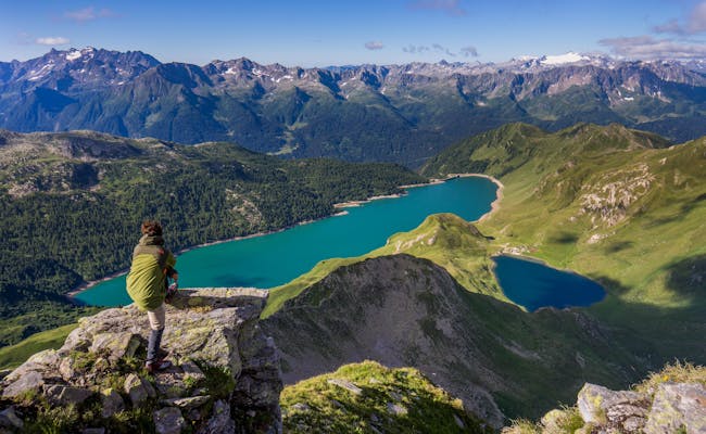 Bergsee Ritom (Foto: Tessiner Tourismusagentur ATT SA)
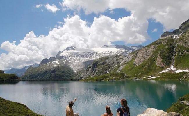 Lago di Robiei (Foto: Tessiner Tourismusagentur ATT SA)
Ticino includes no less than 135 valleys and side valleys. Most of the valleys are very suitable for hiking or biking. Other valleys contain impassable gorges that are an Eldorado for active canyoning. If you want to try this for the first time on vacation or on a weekend, you can easily find certified canyoning guides.
The Vallemaggia is located at the northern end of Lake Maggiore and extends to the Lepontine Alps. Hikers and nature lovers come here. The most important valley in Ticino has a high number of side valleys and occupies about twenty percent of Ticino in terms of area. Fresh and clear water gushes between steep rock faces. The valley is known for its beautiful waterfalls. The side valleys run up to rugged rocky landscapes of the alpine regions and to crystal clear mountain lakes. In a side valley lies Bosco Gurin, an old Walser village. Here, people still speak an Alemannic dialect that closely resembles medieval Alemannic.
The power of the river has created some niches that are used by animals. Among the most internationally important alluvial landscapes is the part of the valley that runs between Riveo and Giumaglio. The evergreen valley contains altitude differences of up to 3,000 meters. The entire flora of Switzerland can be found here. In the middle of the valley runs a sweeping river landscape. The force of the water has gathered huge deposits between Cavergno and Avegno. Everywhere gravel and sand banks formed, which are gladly used for bathing in the clear water.
The Verzasca Valley belongs to the district of Locarno. The very long main valley leads directly to Lake Maggiore. Within the valley there are authentic mountain villages in the middle of an intact nature. The water in the Verzasca Valley does not look blue, it is emerald green
The network of hiking trails in this region is about 300 km long. It ranges from high mountain tours to passes, alps and mountain peaks to themed trails or relaxing walks along the lake shores. By bike, the route Brione Verzasca - Sonogno is very popular.
Like James Bond, here you can experience a day full of thrills: with the most famous bungee jump in the world, which reaches 220 meters down from the dam wall and provides a particularly great adrenaline rush.
Val di Vira is located directly on Lake Maggiore and begins at the village of Vira. The valley leads in a southerly direction to the mountain pass Alpe di Neggia. The valley consists of an adventurous gorge landscape alternating with green stream landscapes. The short gorge sections are often used for beginner canyoning courses. There are well suited rappelling points, slides or jumping points.
A side valley of the Leventina Valley in northern Ticino, the Piora Valley is reached by one of the steepest funicular railroads in Europe. The Ritom-Piora cableway has to cope with a maximum gradient of 87.8 percent. In the Alpe Piora you can hike or take a walk around the Ritom lake. It is the largest mountain lake in Ticino and has an interesting nature trail. The hiking trail around the glittering lakes is popular. Bikers and anglers also get their money's worth up here. The intact nature has especially many plant and animal species.
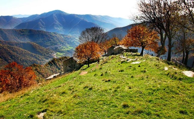 Muggiotal (Foto: Tessiner Tourismusagentur ATT SA)
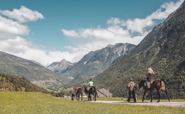 Bleniotal (Foto: Tessiner Tourismusagentur ATT SA)
The Blenio Valley stretches from the north (Lukmanier Pass) to the south until Biasca. Here the Brenno River, which flows through the valley, joins the Ticino River. The valley is also called the Sun Valley because of a strong solar radiation. It is also famous for the number of ancient Roman churches in the valley that can be visited. They are located, for example, in Olivone, Aquila, Torre and Malvaglia. The valley is also famous for its "cave castles" (also called Casa dei Pagani pagan houses). These medieval fortifications were built in particularly inaccessible places. Remains of them can be seen in Marolta, Dongio and Malvaglia
The Muggio Valley is located at the foot of Monte Generoso, southeast of Lake Lugano. It borders directly on Italy near Lake Como. It offers above all tranquility and contact with nature. Cattle pastures and forests stretch along at an altitude between 300 and 1700 meters above sea level. For hikers, the flora and fauna is attractive. Besides cyclamen, violets, gentian and primrose, lady's mantle and hellebores grow here. Chamois can be found especially near Monte Generoso, also deer and roe deer live again in the Muggio Valley.
The river Breggia runs within the Ticino in the Mendrisiotto. It flows through the wooded Muggio Valley. The Breggia gorges have geologically and paleontologically interesting features. The erosion of the water has brought to light rock formations that were formed 80 million years ago. Fossils can be seen in the rocks, but also the consequences of submarine avalanches and evidence of climatic changes were visible here
These findings made the nature park so valuable. Thanks to them, the formation of the basin of Monte Generoso could be reconstructed. In the Breggia Valley there are numerous endangered and protected animal and plant species. Historically interesting buildings are at Castel San Pietro the 12th century castle and the 14th century Red Church. The gorges of the Breggia Valley can be walked along a marked path.
The Val Grande National Park is located between Lake Maggiore and the Val d'Ossola. It covers an area of 14,600 hectares. The national park is said to be the largest wilderness protected area in the Alpine region. The western part of the park is difficult to access and includes the Val Grande proper
The valley is about 25 kilometers long and is almost uninhabited. It is dominated in the upper part by a rocky massif, Pizzo Mottac, which is 1,809 meters above sea level. The middle part is a wild gorge dominated by rocky bands and steep woods. Only the lower part is accessible by road and partially inhabited. In Val Grande it is possible to go canyoning
The Val d`Iragna is a long side valley of the Riviera valley. It is very impassable and therefore hardly visited by hikers. Nevertheless, there is a hiking trail marked in white-red-white. It leads from the village square over a bridge and through woods of huge chestnut trees to the Citt Maiensäss
However, the valley is best known for its five gorges, which are used for canyoning. Among them is the Lodrino Canyon. The canyon is one of the most beautiful in Europe. It has many narrows, deeply cut gorges and an impressive waterfall. The canyon is a popular training area for experienced canyoneers
The lower course of the Boggera River is also characterized by deep gorges and roaring water. The clear water and many natural slides make the Boggera Canyon a popular canyoning destination.
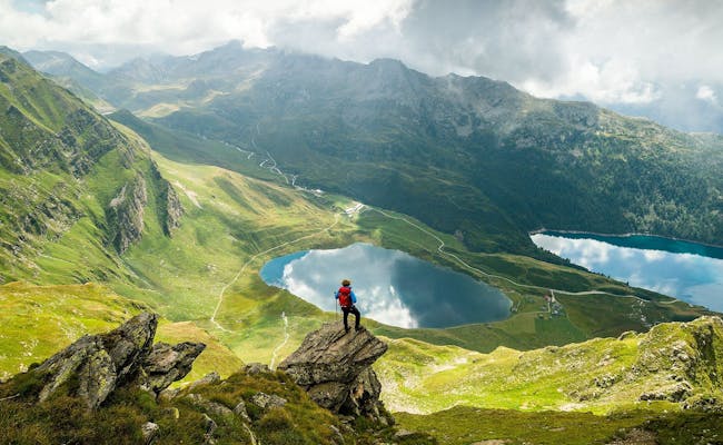 (Foto: Tessiner Tourismusagentur ATT SA)
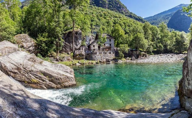 (Foto: Tessiner Tourismusagentur ATT SA)
The insider tips for Ticino include particularly beautiful places or views, free offers or unique experiences
Art and culture center
The Art and Culture Center in Lugano costs 15 CHF to enter. However, it can be visited for free on the first Thursday of every month between 5:00 and 8:00 pm.
Free city tours
The Lugano Tourist Office offers some city tours free of charge. It is best to ask for advice directly at a tourist office or by phone. Several excursions by boat in the nearby surroundings (Monte Brè, village of Gandria) are also accompanied by a free guide. Especially recommended is the guided tour "Unexpected Classic", which is conducted on Mondays by actors in costume very entertaining.
Renaissance fresco
The most famous Renaissance fresco in Switzerland can be admired in the church of Santa Maria degli Angioli in Lugano. It was created in 1529. The entire surface of the nave wall is covered with vivid and expressive scenes of the Passion of Christ. The church stands at the end of the shopping street Via Nassa, in Piazza Bernardino Luini.
Monte San Salvatore
Mount San Salvatore is also called the Sugar Loaf of Switzerland. Its summit reaches 912 meters above sea level and has a 360 degree panoramic view from a small observation tower and is considered the most beautiful panoramic mountain in Ticino. Lake Lugano contrasts with the mountains of the Swiss Alps in the background.
Maggia Valley
In the Maggia Valley you will experience pure nature. The valley, which occupies about 20 percent of Ticino, is home to a great many animal species. About a quarter of all species that exist in Switzerland can be found here. On hikes through the valley, you are very likely to encounter some of the animals that thrive in the valley. In addition, all the plants of Switzerland can be found here in the evergreen valley. It is considered a natural paradise.
Foroglio
At Foroglio, in the Maggia Valley, you will find a waterfall that falls 80 meters. It can be reached by turning into Val Bavona at Bignasco. This valley is the most rocky and also the steepest valley of the alpine ridge.
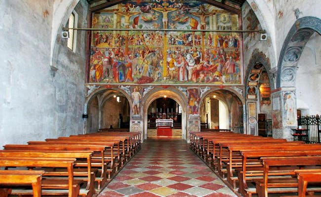 (Foto: Tessiner Tourismusagentur ATT SA)
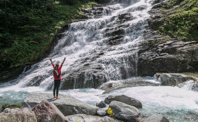 (Foto: Tessiner Tourismusagentur ATT SA)
Monte Generoso
Monte Generoso offers a view of the entire Alpine arc with the lake landscape as a contrast. The view goes from the Maritime Alps in the southwest to the Piz Bernina in the Eastern Alps. The mountain is reached by rack railroad from Capolago on Lake Lugano.
Cadagnosee
Lake Cadagno in the Piora Valley consists of two lakes, one above the other. One of the lakes has clear fresh water and the other consists of salt water. Both lakes never mix. Scientists from all over the world come here to experience this phenomenon called "geogenic meromixis". However, the only way to get here is by funicular and a subsequent hike.
Roman churches
Those who love ancient Roman churches should plan a visit to the Blenio Valley. The most famous of these churches are in Olivone, Aquila, Torre and Malvaglia. The valley is also famous for its cave castles (also called "pagan houses"). They were built in the Middle Ages as fortified structures in particularly inaccessible places and are still visible in parts.
Riva San Vitale
In the village of Riva San Vitale stands the oldest Christian building in Switzerland. The Baptistery, dating from the 5th century, stands at the southern end of Lake Lugano.
Val Malvaglia
In Val Malvaglia there are old settlements from the 13th century called Ville. The houses are built of flat stones stacked on top of each other and inhabited. There are also old bread ovens and a water mill to visit.
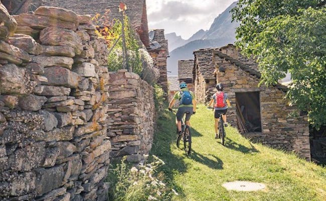 (Foto: Tessiner Tourismusagentur ATT SA)
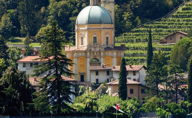 (Foto: Tessiner Tourismusagentur ATT SA)
In February, the city of Bellinzona becomes a boisterous celebration site during carnival time. More than 150,000 guests come to Bellinzona during Carnival Week to celebrate carnival for five days in the kingdom of King Rabadan
On Maundy Thursday, "Dirty Thursday", "King Rabadan" receives the symbolic key to the city gate for the next five days. On Friday there is a children's parade and on Saturday there are concerts by Guggen musicians from Ticino and German-speaking Switzerland
The highlight of Rabadan is the big parade on Sunday. Fifty floats and Guggen groups take part. In addition, there are carnival activities such as mask competitions, street theater, rope pulling tournaments and much more. In the festival hut the party goes on until the early hours of the morning. Tickets are available at the tourist office in Bellinzona.
A special highlight on Lake Maggiore is the annual international sailing regatta week. The Laveno Ascona sailing regatta takes place in June. The surrounding mountain landscapes provide the appropriate backdrop.
This festival takes place in the open air in the Borgo for ten days. International jazz musicians come to Ascona and among them there have been many legends in the last 20 years. 200 jazz concerts are given between the end of June and the beginning of July in different places in the old town.
In July, young musicians in Lugano, Locarno and Ascona invite you to listen to their music. They come from all over the world.
From August to October there are always musical weeks that attract music groups or orchestras to Ascona. The chestnut festival is one of these occasions. Chestnuts and products from them are offered everywhere on open fire and as an accompaniment there is music.
The markets of regional goods are held every year from the end of June to mid-September, initially on Sundays, as a passport market. The goods produced on the Alps are brought to the customers. Alternately, the pass market is held on the Lukmanier, the Gotthard, the Klausen, Oberalp and Flüela.
In the months of September and October, the markets are held on Saturdays in Ticino (in Ascona, Locarno, Bellinzona, Lugano (or Cevio). There are 25-30 farms participating each time. The farms certified by Alpinavera carry the "regio.garantie" sign. You should have plenty of time to visit one of these markets.
The Locarno Film Festival is one of the most renowned film festivals in Europe. Four competitions take place over a total of eleven days:
The Streetfood Festival is held in Bellinzona for three consecutive days in August. It features more than 50 food stalls from all over the world. A total of 35 countries are represented.
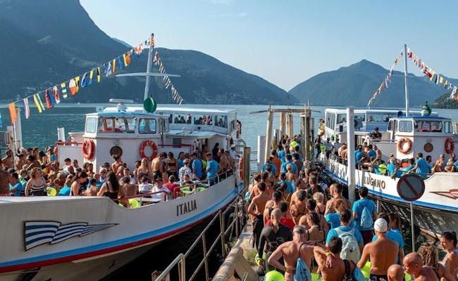
Traditionally, the lake crossing takes place as a popular swim around the end of August. In the process, 2,500 meters are crossed. Participation is allowed from 14 years and costs CHF 25,00 (on site 40,00). It is not a competition.
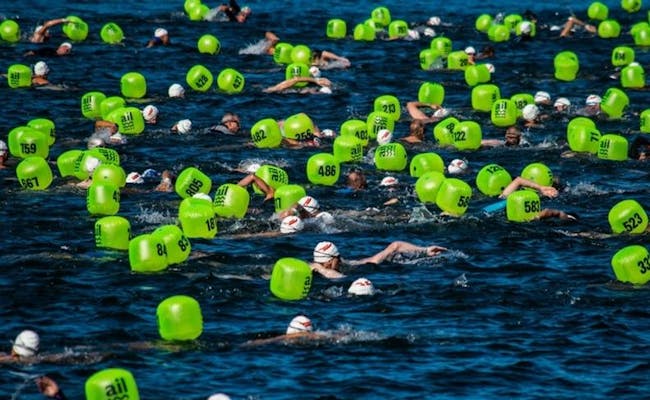 (Foto: Tessiner Tourismusagentur ATT SA)
 (Foto: Tessiner Tourismusagentur ATT SA)
During two days at the end of August, sporting competitions will take place in the city center of Lugano, for which athletes can register
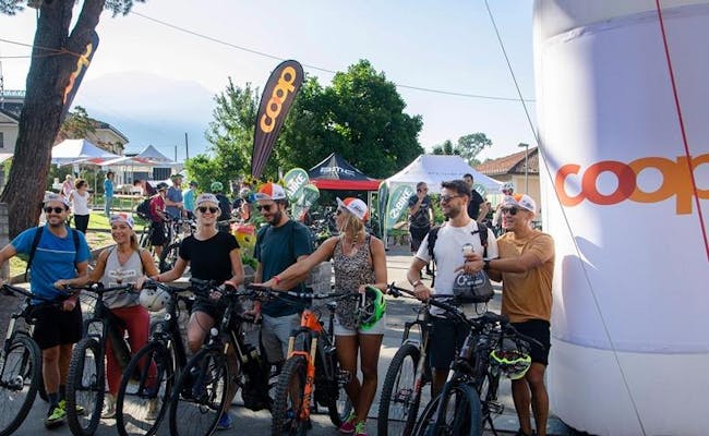
An oenogastronomic bike tour will take place at the end of August in 10 stages along the roads and paths of Capriasca (Tesserete). On the way, some farms will be visited where local products will be tasted.
During four days at the beginning of September, all the novelties of the Geneva Motor Show will be presented open air in the urban area of Lugano. In 2021, the Autonassa will be held in conjunction with the Nassa Boat Show.
At the end of September, an uphill race is held from Miglieglia in Malcantone to the summit of Monte Lema.
Above Bellinzona, every year in June, there is a cable car festival of the small cable car Camorino - Monti di Croveggia on the mountain. The cabins date back to 1970.
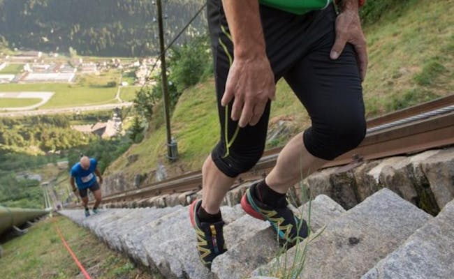
In mid-October, a race is held along the 1.3-kilometer-long historic staircase of the Piotta-Ritom funicular. Starways to Heaven. There are 4261 steps to climb on this race. Since the gradient is up to 89%, 790 meters of altitude are climbed on this course. The records are about half an hour (women) and 25 minutes (men).
 (Foto: Tessiner Tourismusagentur ATT SA)
 (Foto: Tessiner Tourismusagentur ATT SA)
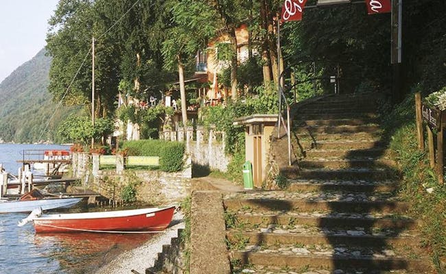
Restaurants in Ticino offer mostly regional cuisine, which is very much influenced by Italian cuisine. Mountain restaurants are popular, located on mostly sunny and panoramic terraces with large terraces.
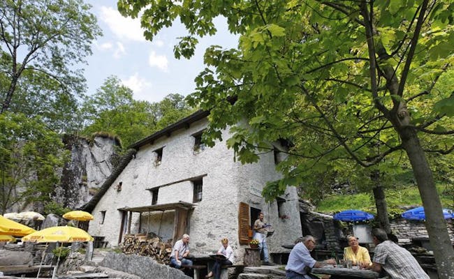
Typical for Ticino are the grotti. These are small rural and rustic restaurants, mostly located in remote and shady places. These places were used by previous generations as refrigerators. Today, there are granite tables and benches where local dishes are served. These include polenta with braised meat, minestrone, tripe, risotto, cold cuts and cheeses. These are accompanied by Merlot or Gazzosa, the typical lemonade. You can find a grotto almost everywhere in Ticino.
 (Foto: Tessiner Tourismusagentur ATT SA)
 (Foto: Tessiner Tourismusagentur ATT SA)
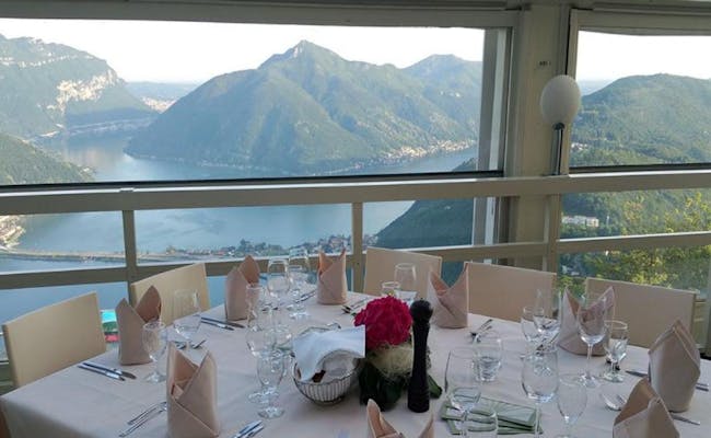
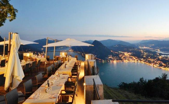
Restaurant Vetta San Salvatore has a total of 200 seats for guests. They are located on an outdoor terrace and in a panoramic terrace. Mediterranean cuisine with regional ingredients is a matter of course in the kitchen. Whether coffee break, small dishes or extensive lunch, everything is possible. At the same time you can enjoy the panorama of Lake Lugano and the surrounding mountains. Every day a different daily plate is offered and in combination with the mountain railroad ticket there are special offers for 32 CHF
Open from mid May to mid September
There is also a Ristorante Vetta at Monte Brè. Typical Ticino dishes are served here. In addition to a large hall, there is also a large outdoor terrace. This restaurant can also be reached by car from Cassarate or Viganello
The restaurant is open
 (Foto: Tessiner Tourismusagentur ATT SA)
 (Foto: Tessiner Tourismusagentur ATT SA)
Hotels and accommodations in Ticino are very diverse. In the cities of the tourist areas you can find noble 4 and 5 star hotels with spa or also sports hotels that have hired the experts of certain sports right away.
In remote places in the valleys and mountains there are rather small cottages with traditional restaurant or there are only bed&breakfast. Besides those listed here, there are many other and very different accommodations.
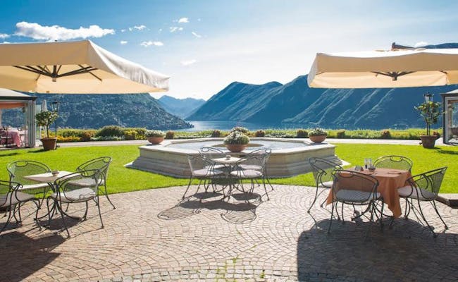
This five-star luxury hotel combines a Mediterranean style with elegance. In fact, the residence used to be that of a real prince. The large pool in the garden and the view of Lake Lugano and the surrounding mountains are also quite princely. The restaurant is well known and the flagship of the hotel. In the evenings live music is played in the piano bar and during the day you can pamper yourself in the SPA. The hotel is located in Lugano near Lake Lugano.
The Gorda hut is located in Aquila in the municipality of Blenio at 1800 meters above sea level. From here you can watch the starry sky from the huge glass windows. The hut belongs to the alpine association Adlerhorst (SANDA). It is equipped with a wind turbine. From the hut you can see over the Adula and the whole valley floor. The hut is accessible by road.
The hut has 28 beds (two 8-bed rooms, one 10-bed room, one 2-bed room).
Hiking excursions from here:
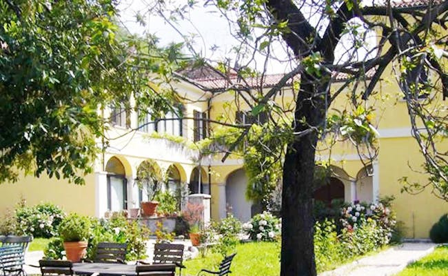
In the picturesque region of Mendrisotto in southern Ticino stands the B&B La Villa. The building was built in 1746 and is furnished with antique furniture and balconies. It is picturesquely situated on a hill of the wine village. A large park with old trees surrounds the villa. In summer breakfast is served in the garden. In total this accommodation has 4 beds available.
From here you can reach the A2 freeway in two km. Mendrisio, Lake Maggiore or Lake Como are quickly reached via it. For hiking the mountain landscape of San Giorgio is wonderful.
 (Foto: Tessiner Tourismusagentur ATT SA)
 (Foto: Tessiner Tourismusagentur ATT SA)
Ticino is located in the south of Switzerland and is enclosed in its southernmost part by Italy.
From the north you can reach Ticino via the A2 freeway. It leads through the Gotthard tunnel. To reach Lake Maggiore, take the Bellinzona South exit in the direction of Locarno. Lake Lugano is directly on the A2 freeway, which even crosses it.
From the south, one can use the lake freeway A9 from Milan or the A8 from Varese.
In summer the alpine passes Saint Gotthard, San Bernardino, Nufenen and Lukmanier can be used.
The San Bernardino pass leads from Chur to Ticino at an altitude of 2,065 meters above sea level. It crosses the Hinterrhein valley and the Grisons Alps. The landscape consists of pine forests, swamps and mountain lakes.
The Saint Gotthard pass is situated at 2,106 m above sea level. It has been one of the most important north-south connections since the Middle Ages. It connects Uri with the Ticino. When the railroad and highway tunnels were built, the traffic shifted. Nevertheless, it is still called the Gotthard axis today
The Gotthard Pass is a Swiss myth. To it belong inseparably such historical names as the Devil's Bridge, the Schöllenen Gorge, the Urnerloch (the oldest tunnel in the Alps), the Suwarow Monument, the Reduit, the Tremola and the old Sust near the Hospiz
The Lukmanier Pass is located at 1,915 m.a.s.l. It connects Graubünden with Ticino and leads directly into the Blenio Valley, also known as the Sun Valley. Allegedly, this pass was the favorite pass of Barbarossa.
The Nufenen Pass connects Valais with Ticino at an altitude of 2,439 meters above sea level. It also separates the Gotthard Group, which lies to the north, from the Leone Group, which lies to the south. The pass road leads from Ulrichen in the district of Goms to the Bedretto Valley (Val Bedretto).
Fast trains from Zurich take a similar route to the A2. The IC2 goes via Bellincona to Lugano in two hours. By car, this route takes at least three hours. The regional trains and bus lines in Ticino are very well connected.
Trains from both German-speaking Switzerland and Milan run every hour. The opening of the new Ceneri Base Tunnel as a southern connection to the Gotthard Base Tunnel made it even easier and faster to discover this diverse southern Switzerland.
By plane you fly to the airport Lugano-Agno. It is located virtually between Zurich and Milan and is only a few kilometers from the center of Lugano. The airport is open to private traffic. The airline Silver Air flies to it in the summer. It is a company that operates charter flights.
 (Foto: Tessiner Tourismusagentur ATT SA)
 (Foto: Tessiner Tourismusagentur ATT SA)
The climate in Ticino varies. In general, Ticino has a pleasant continental climate. South of the Alps, however, the cold air masses from the north are largely held back. Thus, the warm Mediterranean climate can spread well in Ticino and leads to the fact that Ticino is called the "sunroom of Switzerland". The warmest city in Ticino is Locarno.
Locarno has an average of 100 rainy days per year (Zurich 160). The sunshine hours in Locarno reach 2300 hours (Zurich 1878 hours).
On the Brissago Islands in Lake Maggiore it is even warmer. Here there is a so-called insubric climate: there is a lot of precipitation, but also just as many hours of sunshine. Here the average annual temperature is 14°C and the islands have no ice days (days when the temperature stays below 0°C). As a result, especially exotic species of plants and palms thrive on these islands.
However, in the lake area of Ticino, particularly violent thunderstorms can occur more frequently in the summer. In October 2000, the Piazza of Locarno was under water and the population had to move around in boats.
Nevertheless, the best time to travel is between June and September, as precipitation tends to be low on average, with pleasant temperatures. Most precipitation falls in the months of May, October and November
| average temperature | average precipitation | |
|---|---|---|
| January | 4 °C | 7 mm |
| February | 5 °C | 14 mm |
| March | 10 °C | 12 mm |
| April | 14 °C | 14 mm |
| May | 18 °C | 20 mm |
| June | 22 °C | 12 mm |
| July | 25 °C | 11 mm |
| August | 24 °C | 13 mm |
| September | 20 °C | 10 mm |
| October | 15 °C | 37 mm |
| November | 9 °C | 49 mm |
| December | 5 °C | 6 mm |